Welcome to
Ela Meteora Trikala

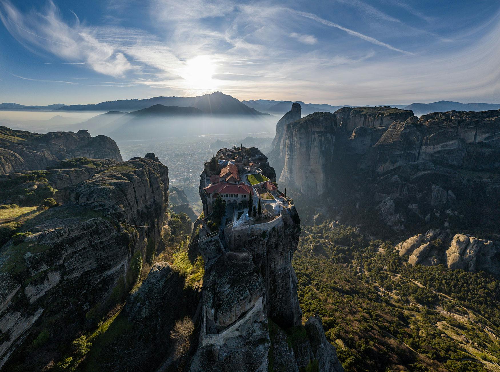
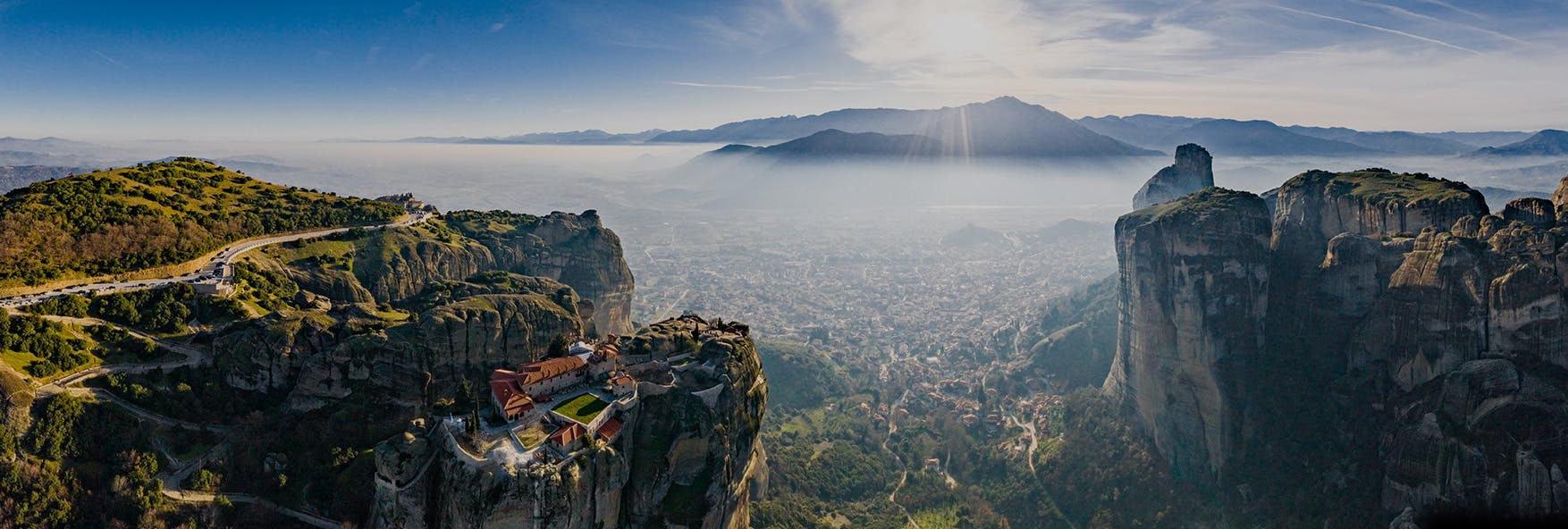
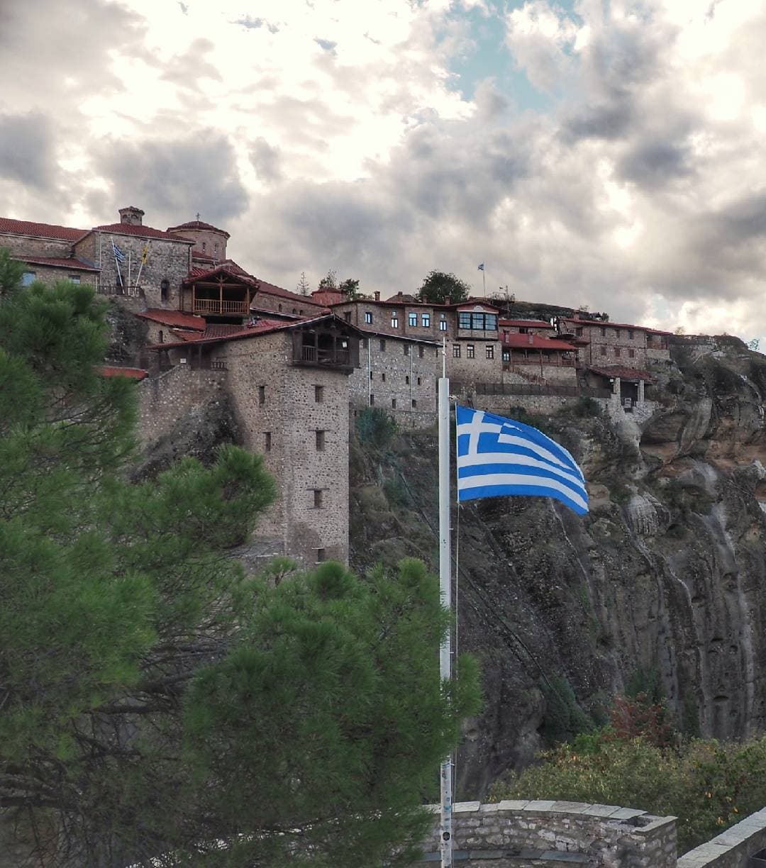
The place we are called to promote begins about 30 million years ago with Meteora reminding us of it.

nikos.mertsiotis.grandewill13

Pyli – Trypio Lithari – Glykomilia

This is the central path that crosses Mount Koziakas, with direction to North-South.

Its first and easiest part starts from the village of Pyli to the south, up to a location named Trypio Lithari. The path begins from the well-known monastery of Porta Panagia, which is located in Pyli, Trikala. It then moves to the famous arched bridge of Pyli and climbs to Mount Koziakas, next to the fencing of the controlled hunting ground. It leads to beautiful valleys and heads to the north, passing along Mpei Location. It also passes from a kiosk in the location Kosta’s Fir Tree, which was destroyed after a tree fall and from a kiosk in the location Kanalia, finally ending to Trypio Lithari. This forest along the backbone of the mountain is of stunning beauty, full of tall fir trees and large ferns.

Trypio Lithari is a hotspot in this mountain, found under the east sides of the top. It is a central place, where numerous paths that lead to the top or to the refuge all radially meet.

The path after Trypio Lithari up until Glykomilia to the north is a big and very demanding part of the route. Twenty minutes after we start walking from Trypio Lithari, we find ourselves in a plateau and in one of the very limited places with a great view to the mountain slopes and to the valley of Trikala. This spot is marked by the waypoint VIEW. Shortly after that, we get to really steep descent to an area that is full of dense deciduous trees. The layer of leaves that has been created in there makes things incredibly difficult. In the future, the goal is to construct a stairway there. Until then, the only secure way to descent is using a rope. This spot is marked by the waypoint DESCENT. The forest that follows is so rewarding! However, we should pay a lot of attention not to lose marks. In that place, the path leads to a dirt road, which we should follow until we get to the beautiful kiosk in Gkoura Location. Then, we remain in this path, until we arrive in Glykomilia.

There are many short parts of this route after the waypoint of DESCENT, both before and after Gkoura , which have never been detected by a gps and are just marked by a single line.


Length: 24501 m.

Alt. Ascent: 2701 m.

Alt. Descent: 2951 m.

Maximum Altitude: 1705 m.

Minimum Altitude: -237 m.

Τrackpoints: 930

Be inspired and discover top experiences

Experience

Theopetra Cave – the origin of all

Being the most important cave in the Greek territory and one ...

Read more

Thematic

Meteora – Monastic community

Did man climb Meteora Rocks, so as to reach the sky, in his ...

Read more

Explore

Old Stone Bridge of Palaiokarya

Palaiokarya is a village with many roots. It is usual for pe ...

Read more

Experience

Hellenic Culture Museum – timeless and precious

The Hellenic Culture Museum is located in the city center of ...

Read more